Defaults
defaultMarkerColor=#3367d6,showLegend=true,autoFit=true.fitPadding=32,mapTypeId=roadmap,height=320px.infoWindowEnabled=true,markerLimit=50.
Widget reference
For live data, set preserveViewportOnRefresh: true to fit the initial non-empty result while retaining the camera on subsequent updates. Optional viewportKeyField names a row field whose changed values trigger a new fit, such as a selected region. Camera-option changes or a new map also refit. 2D and 3D markers with stable trackByField IDs update in place; classic and advanced 2D markers retain their identity while position, title, colors and icons update. Missing targets are removed and open details use the latest row. Ordinary refreshes retain available map content while loading. These options require frontend support.
Map widgets tonen geolocaties met statuskleurregels, marker-iconen, info window velden, viewport gedrag en geavanceerde map options.
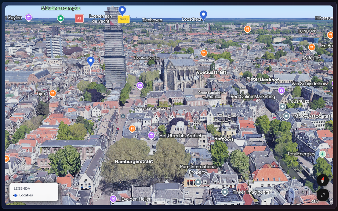
defaultMarkerColor=#3367d6, showLegend=true, autoFit=true.fitPadding=32, mapTypeId=roadmap, height=320px.infoWindowEnabled=true, markerLimit=50.| Key | Type | Beschrijving |
|---|---|---|
filter | object | Widget filter JSON. |
latField, lngField | string | Bronvelden met coordinaten. |
titleField, subtitleField, descriptionField | string | Tekstvelden in marker/info popup. |
statusField | string | Statusbron voor kleurmapping. |
infoFields | string[] | Extra velden in info window. |
trackByField | string | Stabiele marker-identiteit over refreshes. |
renderMode | string | 2d (default) of 3d. |
| Instelling | Beschrijving |
|---|---|
showLegend | Toont statuslegend bij statuskleurregels. |
autoFit | Auto zoom/center op marker-bounds. |
defaultZoom | Fallback startzoom. |
maxAutoZoom | Bovengrens voor auto-fit zoom. |
fitPadding | Padding rondom marker-bounds in pixels. |
defaultCenter.lat/lng | Fallback center als auto-fit niet mogelijk is. |
mapTypeId | roadmap, satellite, hybrid, terrain. |
height | CSS hoogte van de kaartcontainer. |
markerLimit | Maximaal aantal markers dat gerenderd wordt. |
statusColors is een map van statuswaarde naar kleur.statusPriority bepaalt sorteer-/weergaveprioriteit.defaultMarkerColor wordt gebruikt bij missende statusmatch.colorByComparisonSet laat kleuren door compare-set context sturen.markerIconField gebruikt datawaarde als icon bron.markerIconClass is statische fallback icon class.infoWindow aan/uit bepaalt popup-rendering.apiKey kan widget-specifieke map key overriden.| Key | Type | Notities |
|---|---|---|
libraries | string[] | Komma-lijst in editor, als array opgeslagen. |
mapOptions | object | Advanced map opties JSON; moet object zijn. |
apiKey | string | Alleen invullen wanneer override nodig is. |
defaultCenter wordt alleen opgeslagen als zowel lat als lng numeriek zijn.{
"latField": "latitude",
"lngField": "longitude",
"titleField": "store_name",
"statusField": "store_status",
"statusColors": {
"open": "#22c55e",
"maintenance": "#f59e0b",
"closed": "#ef4444"
},
"defaultMarkerColor": "#3367d6",
"autoFit": true,
"maxAutoZoom": 13,
"mapTypeId": "roadmap",
"height": "360px",
"infoFields": ["city", "region", "manager"],
"markerIconClass": "pi pi-map-marker",
"markerLimit": 200
}